

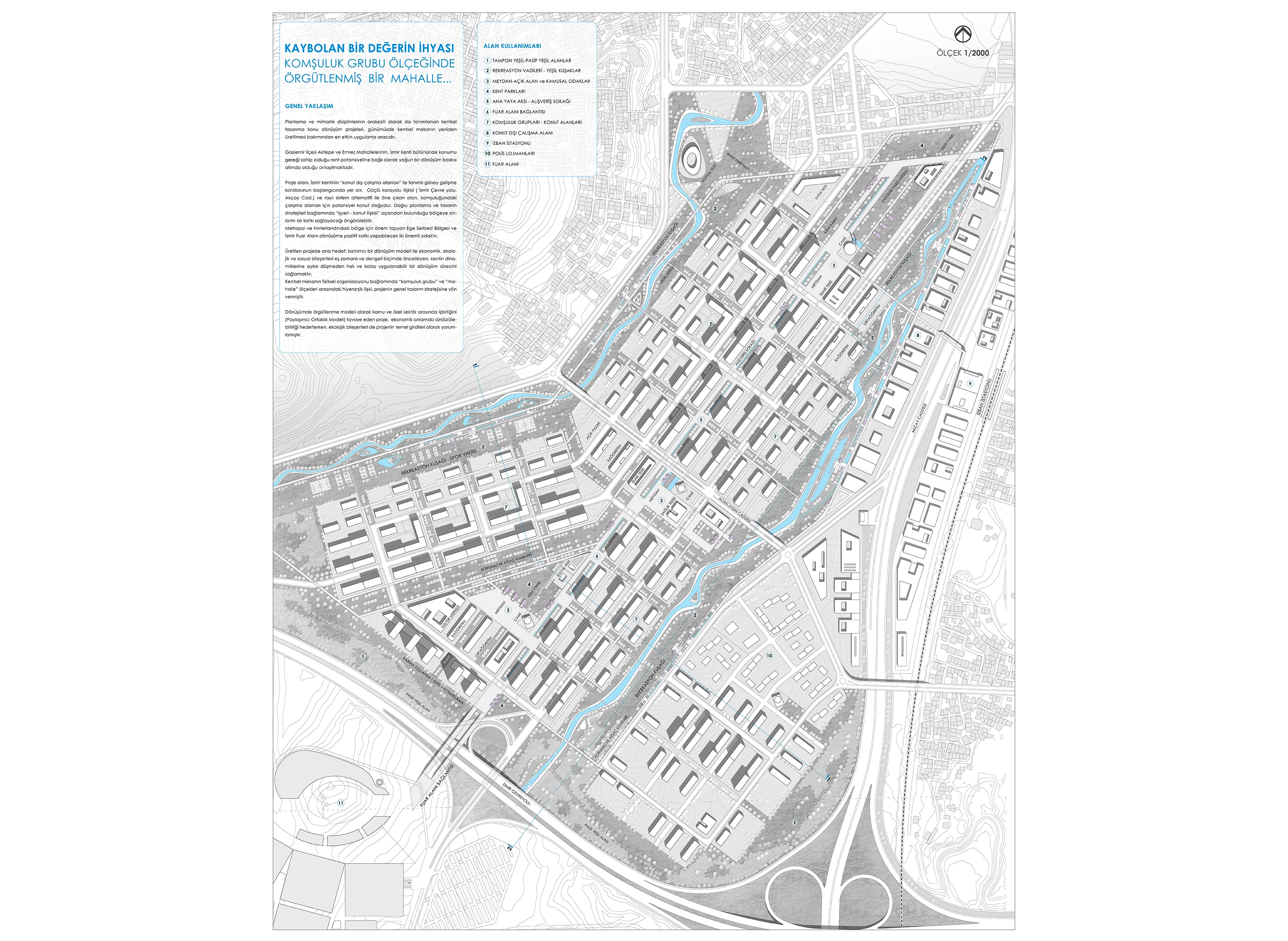
The project area is located at the beginning of the southern development corridor defined by the ‘non-residential working areas’ of the city of Izmir. The area that stands out with its strong highway relation (İzmir Ring Road, Akçay Street) and rail system alternative is the potential housing stock for the neighboring working areas. In terms of correct planning and design strategies, it can be foreseen that 'workplace - housing relationship' will make a significant contribution to the region. The Aegean Free Zone and the Izmir Fairground, which are important for the region in the metropolitan and hinterland, are two important focuses that can contribute positively to the transformation.
DESIGN PRINCIPLES
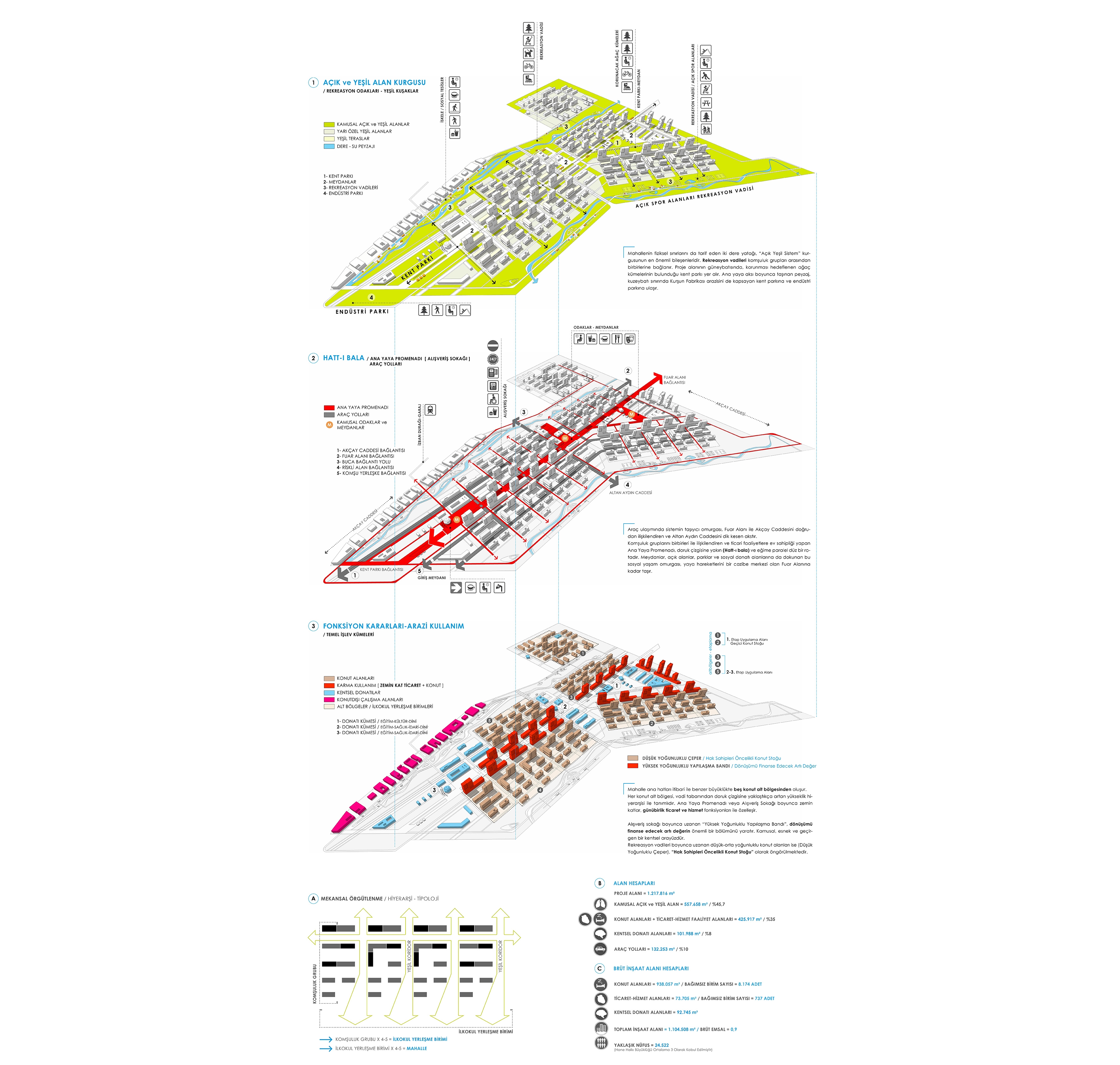
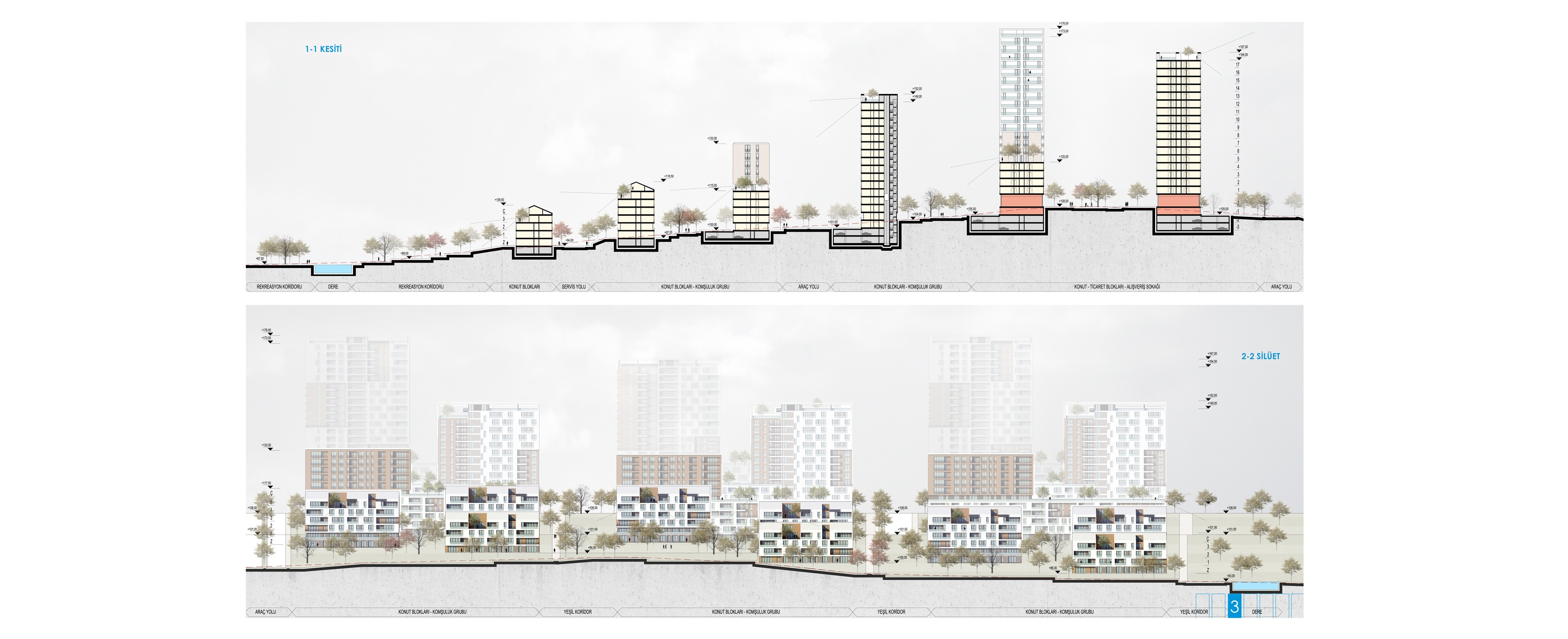
The project area is defined by the formation of two valley beds and valleys with northeast-southwest orientation. The characteristic topography physically describes the administrative boundaries of the settlement. The area dominated by the 'dominant orientation' along the summit (hatt-i bala), which forms the backbone of the settlement, is mainly variable in southeast and northwest. The natural dynamics of topography and the clusters that it establishes or will establish in the neighborhood of the area are decisive in the design strategy.
OPEN and GREEN AREAS COURSES
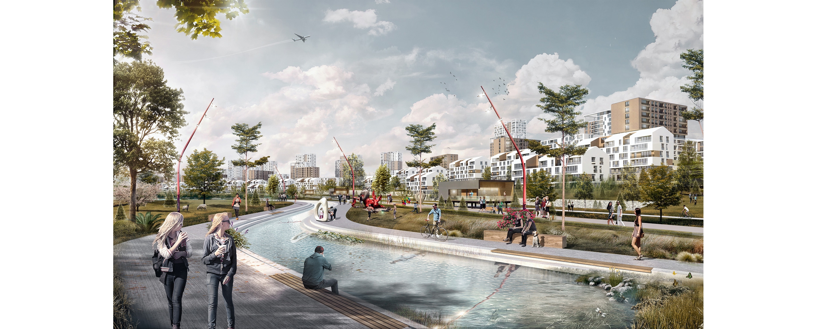
Two river beds, which also describe the physical boundaries of the neighborhood, are the most important components of the 'Light Green System' fiction. These green corridors allow recreative functions in different identities by rehabilitating stream beds and restoration of the valley landscape. (Daily recreation opportunities, hiking and biking trails, outdoor sports areas, etc.)
TRANSPORTATION SYSTEM
The transportation system has been developed considering the superstructure investments (Buca Connection Bridge and fair area connection) to be protected. The carriage backbone of the system in the vehicle transportation is the one that directly connects the Fairground and Akçay Street and cuts the Altan Aydın Street perpendicularly. In the transportation scheme, which allows each development lot to be serviced, there are two other carrier axes extending parallel to the slope in the northeast-southwest axis. These roads are connected to each other along the development lots islands and form the transportation-circulation network.
According to the data of 1/1000 Scale Implementation Development Plan, road-car park surfaces occupy 35% of the land usage distribution. This situation indicates one of the chronic problems of the subdivided parcels and slum morphology. One of the main strategies of the project is that the development lots dimensions and road system, which are optimized by design, allow for more green and open space. In other words, a design based on social facilities and pedestrian access is adopted.
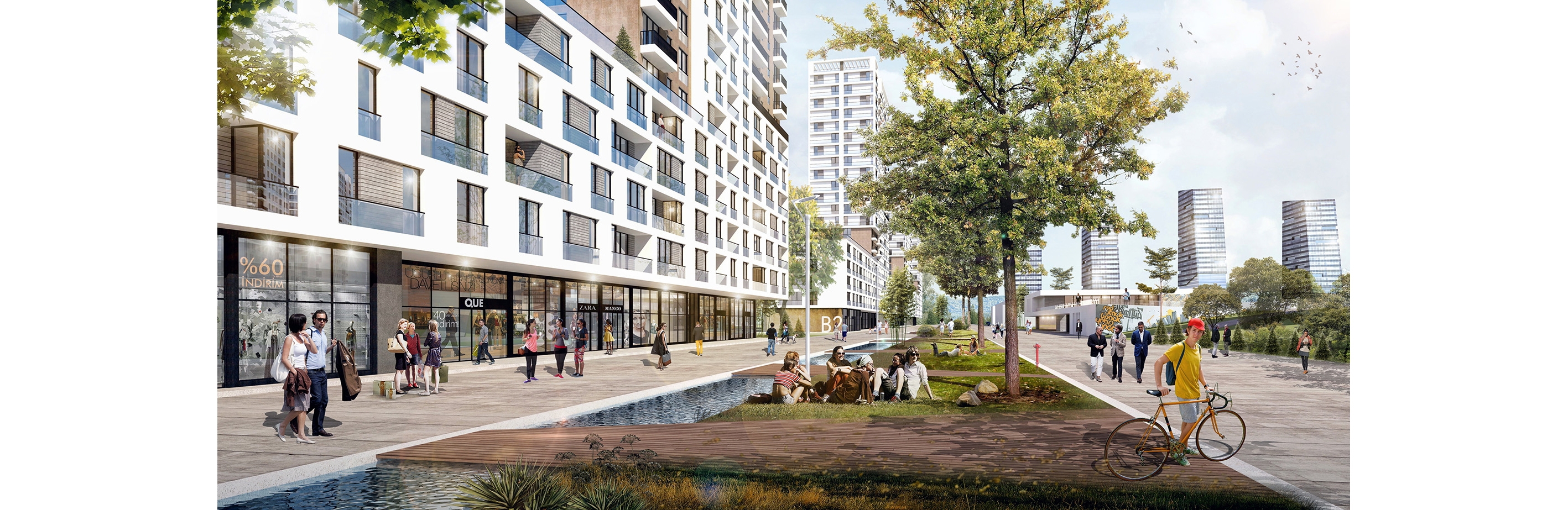
The Main Pedestrian Promenade, which links neighborhood groups and hosts commercial activities, is a straight route close to the peak (Hatt-i bala) and parallel to the slope. This social life backbone, which also touches squares, open spaces, parks and social public facility areas, carries pedestrian movements up to the Fairground, which is an attraction center.

FUNCTION DECISIONS / LAND USE
The neighborhood consists of five residential sub-districts of similar size as the main lines. Four of these sub-regions which can be interpreted as Primary School Settlement Unit constitute the main campus with the integrity defined by the topography. The fifth sub-region is adjacent to the Police Housing.
Each residential sub region is defined by an elevation height hierarchy as it approaches the peak line from the valley floor. The modular rhythm and continuity of the residential areas are divided by the square, park and public facilities clusters and sub-regions are formed. There are two different density bands in the whole project. The 'High Density Construction Tape', which runs along the shopping street, creates a significant portion of the surplus value to finance the transformation. Public is a flexible and permeable urban interface.
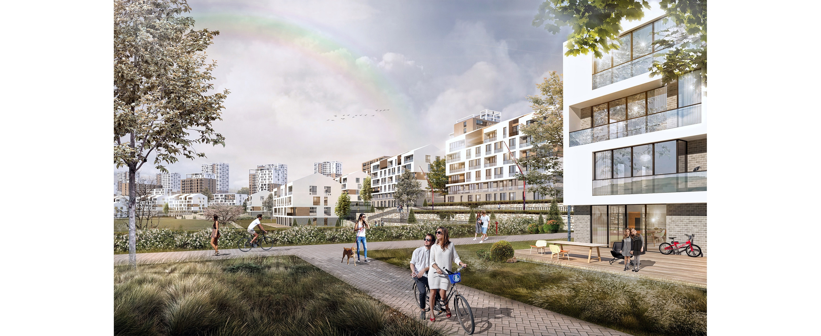
Low-medium density housing areas (Low Density Perimeter) extending along the recreation valleys are foreseen as 'Rights Holders Priority Housing Stock'. The scale as a scale is closer to the culture of life. Repetitive neighborhood group modules point to a morphology that is conducive to informal social relations rather than publicity.
Ground floors along the Main Pedestrian Promenade or Shopping Street are specialized with day-to-day trade and service functions. Office and accommodation functions are located in the neighborhood of the Freeway and Fairground.
In addition to the existing social facilities, administrative facilities, educational facilities, cultural and health facilities are recommended in the campus. Akçay Street has been associated with the campus by designing a reactive urban interface on the non-residential working band, the stream bed and the valley.
Within the scope of the project, the social facilities intended to be protected are added to the design as they are or on parcel-island basis. In order to ensure the design integrity in the medium to long term, symbolic masses are proposed for functions protected on parcel basis.

ARCHITECTURAL CONTEXT
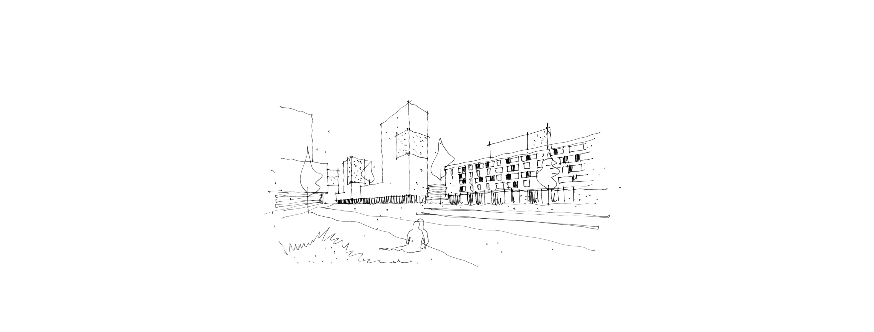
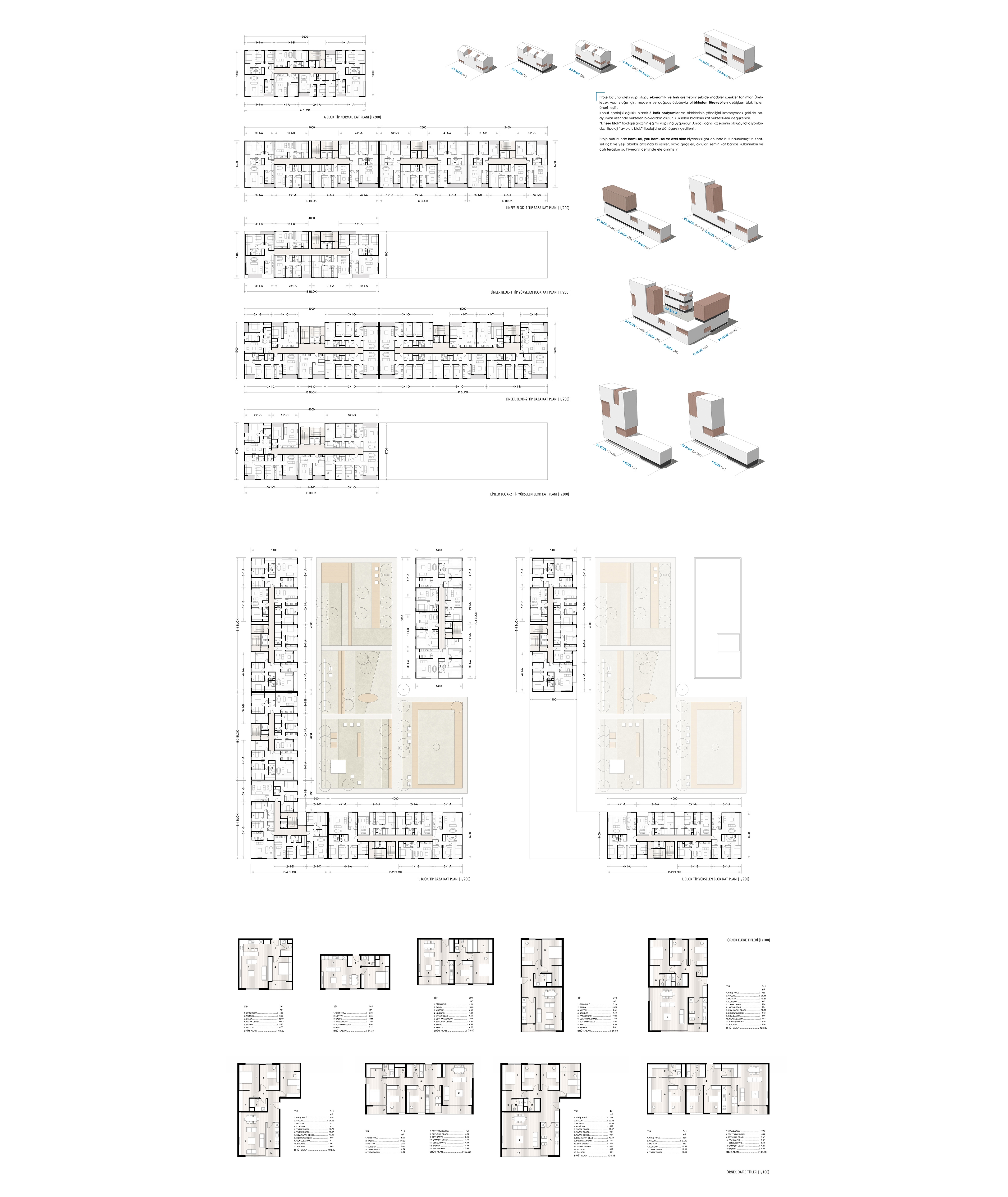
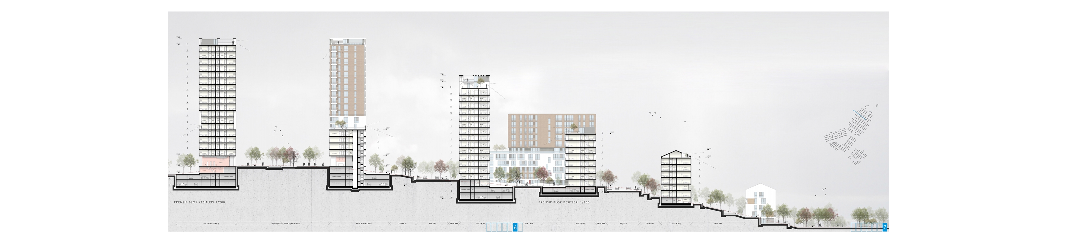
The building stock in the whole project defines modular contents in an economical and fast production manner. Variable block types which can derive from each other in modern and contemporary style have been proposed for the building stock to be produced. The housing typology consists mainly of 5-storey podiums and blocks rising on the catwalks so as not to interrupt each other's orientation. The height of the elevated blocks is variable. The 'linear block' typology is suitable for the slope of the terrain. However, in locations where there is less inclination, the typology is varied by transforming into the typology 'block L'.
In the whole project, the hierarchy of public, semi-public and private space is taken into account. Relationships between urban open and green areas, pedestrian passages, courtyards, ground floor garden uses and roof terraces are discussed in this hierarchy. The roof terraces of the rising blocks and podiums, in addition to the open space usage on the floor, have been evaluated as a floor garden. The aim is to increase the potential of neighborhood and socialization potential through the roofs of the courtyard, the upper floors and the roof terraces.
| Location | İzmir / Gaziemir Aktepe ve Emrez Neighbourhood | |
| Program | National Urban Design and Architectural Project Competition - Equivalent 1. Prize | |
| Size | 120 Ha | |
| Client | İzmir Metropolitan Municipality | |
| Year | 2015 |